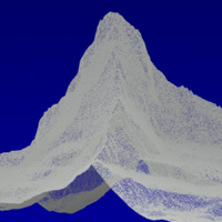
Scatterplot
DHM25©swisstopo
Classic terrain models:
>>>
Most terrain models are manufactured on the basis of geographical maps, where contour lines are translated to thin wafers which are then stacked and glued together. This raw model is then refined ("finishing"), which is a challenging artistic modeling task.
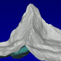
Triangulated model
DHM25©swisstopo
Digital terrain models:
>>>
Thanks to technical advancements in measuring and computer science, digital terrain models have become a common tool. The Swiss Federal Office of Topography [swisstopo] in Wabern near Bern offers a digital model [DHM25] of entire Switzerland. In this model, terrain levels are encoded in network nodes with a distance of 25 meters.
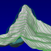
Milling tracks
DHM25©swisstopo
Creation of milling tracks:
>>>
From the digital terrain model, a scatterplot can be derived; if scaled to the desired size, one gets a data structure suitable for milling tracks. First the lattices have to be triangulated, i.e. every mesh is divided into two triangles. This leads to a scatterplot with many more points. In order to improve the representation of sharp rock edges in the milled model, the photogrammetrically acquired edges are converted into a scatterplot as well and fitted into the previously calculated scatterplot. On the basis of this, the milling tracks can be computed [as described in Rapid Modeling by Dr. Joachim Wirth].
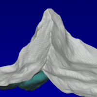
Simulated final contours
DHM25©swisstopo
Team:
>>>
A project of these dimensions can be carried out successfully only through interdisciplinary collaboration of design, computer science, and manufacturing technology.Design / concept: Andreas Fischer
Computer science / engineering: Dr. Joachim Wirth